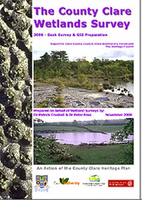
Crushell, P. & Foss, P.J. (2008) The County Clare Wetlands Survey. Desk Survey & GIS Preparation. Report for Clare County Council. pp 139.
The Clare Wetland Survey was carried out by Wetland Surveys Ireland of behalf of Clare County Council, Clare Biodiversity Forum and The Heritage Council. The aim of the survey was to prepare a GIS map data layer and associated database of all known freshwater wetland sites in County Clare. Wetland sites were identified following an extensive review of literature and third party data sources. Information stored on these sites included details of previous surveys and general site characteristics. In addition to the known wetland sites, a GIS dataset was established to record all mapped wetland habitat within the county by incorporating map data provided from third parties along with wetland identified by an analysis of aerial photography of all wetland habitat within the county. Together these datasets facilitated an assessment of the wetland resource of the entire county. During the course of the survey over 34 different wetland habitat types were recorded. In total 2069 wetland habitat units were mapped using GIS, comprising an area of over 23,000 hectares. Detailed information was collated on 300 discrete sites that were been previously reported in the literature. A key result to emerge is that significant gaps exist in relation to our knowledge of this resource, due primarily to a lack of detailed habitat surveys.
A number of wetland habitat types were identified for which habitat data, information on habitat extent, site boundaries and conservation status is lacking in many cases. These should be a priority for survey as part of the ongoing development of a wetland inventory for the county. These habitats include: turloughs, rich fen and flush, tall herb swamp, spring sites and wet grassland.
The most valuable outcome of the CWS are the two databases that have been developed during the course of the survey. These contain a vast array of information on the extent, distribution, previous studies carried out and characteristics of the entire wetland resource in the county. They should prove most useful as information sources for any future investigations into the biodiversity contribution of Clare wetlands.